India's Driest June Since 2014 Leaves Kharif Sowing 23% Behind, Monsoon Finally Stirs
Southwest monsoon belatedly pushes into Uttar Pradesh and Uttarakhand on 30 June, but a 39.8% rainfall deficit across June — the worst since 2014 — has left kharif sowing lagging 23% behind last year's pace.
The short answer
India endured its driest June since 2014, receiving only 99.5 mm of rain against a long-period average of 165.3 mm — a deficit of 39.8%. The sluggish monsoon has cut kharif sown area to 18.272 million hectares as of 25 June, a 23% drop from 23.646 million hectares at the same stage last year. A low-pressure system forecast over the northwest Bay of Bengal around 3 July 2026 is expected to revive monsoon activity and give sowing a critical boost in the days ahead.
Late arrival
Monsoon Finally Stirs After Three Weeks of Stalling
The southwest monsoon's northward march, which had stalled for nearly three weeks, resumed on 30 June when the India Meteorological Department (IMD) confirmed its advance into more parts of Madhya Pradesh, the remaining areas of Chhattisgarh, Jharkhand and Bihar, parts of Uttar Pradesh, most of Uttarakhand, and some pockets of Himachal Pradesh and Ladakh.
The IMD expects conditions to remain favourable over the next two to three days for the monsoon to push further into the remaining parts of Gujarat, Madhya Pradesh, Uttar Pradesh, Uttarakhand, Himachal Pradesh and Ladakh, as well as most parts of Jammu & Kashmir, Haryana, Delhi and Punjab, and some areas of Rajasthan.
A key catalyst is in view: the IMD has forecast the formation of a low-pressure area over the northwest Bay of Bengal around 3 July 2026, which meteorologists believe will reinvigorate monsoon circulation over central India after an extended weak spell. Separately, isolated very heavy rainfall alerts have been issued for Konkan (2–4 July), the Ghat areas of Madhya Maharashtra (2–3 July), and South Gujarat (3–4 July).
Record dry spell
June 2026: The Driest in Over a Decade
India received just 99.5 mm of rainfall in June 2026, sharply below the 1971–2020 long-period average of 165.3 mm — a deficit of 39.8%. That makes this the lowest June total since 2014, when an El Niño year delivered 92.1 mm. For historical context, the driest June on record over the past century was in 2009, when the country received only 87.5 mm.
The IMD attributes the widespread shortfall primarily to El Niño, which has weakened monsoon circulation and slowed the system's northward advance. Regional breakdowns from 1–20 June reveal the breadth of the drought:
- Central India: 50% below normal
- Eastern & Northeastern India: 40% below normal
- Northwest India: 31% below normal
- Southern India: 27% below normal
At the state level, Gujarat bore the worst of it at 82% below normal, followed by Meghalaya at 74% and Chhattisgarh at 65%. Across all districts, nearly 70% of India's 741 districts recorded below-normal rainfall between 1 and 29 June.
Crop calendar at risk
Kharif Sowing Trails Last Year by Nearly a Quarter
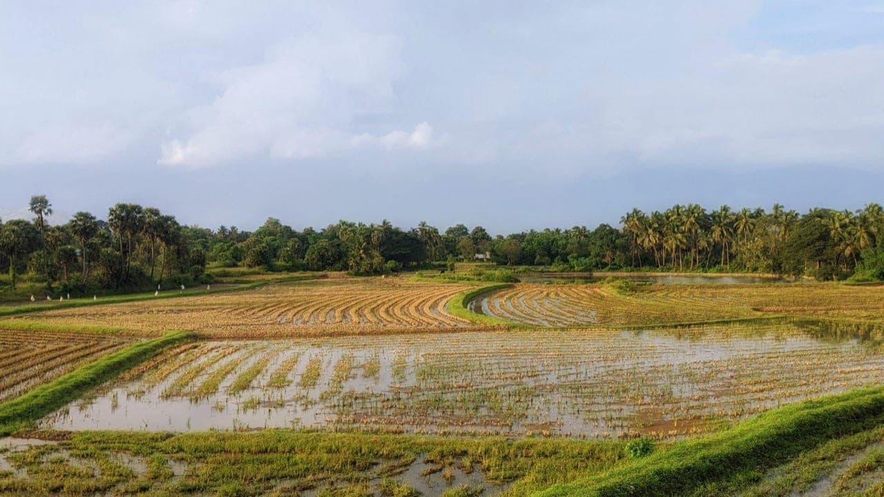
The monsoon's delayed onset and sluggish progress have dealt a direct blow to kharif crop coverage. As of 25 June, the total area sown under kharif crops stood at 18.272 million hectares, compared with 23.646 million hectares at the same stage in 2025 — a shortfall of roughly 23%.
The lag is broad-based, spanning every major kharif crop category: paddy, pulses, oilseeds, coarse cereals, and cotton. No segment has been spared.
The coming days are critical. With the IMD's forecast of a Bay of Bengal low-pressure system set to strengthen monsoon flows from early July, farmers in rain-fed regions will have a narrow window to accelerate planting and close the gap in crop coverage. How quickly the monsoon blankets the remaining northern and central states will determine whether sowing-season losses can be meaningfully recovered before optimal planting windows close.
Why it matters
With nearly 70% of India's 741 districts already recording below-normal rainfall through June, and sowing deficits spread across every major kharif crop — paddy, pulses, oilseeds, coarse cereals, and cotton — the pressure on the first week of July is immense. A meaningful revival hinges on the projected Bay of Bengal low-pressure system delivering on IMD's forecast. Policymakers and agri-businesses should monitor sowing progress closely over the coming fortnight: if the gap is not narrowed quickly, crop-area shortfalls could translate into tighter domestic supply and upward price pressure for key commodities later in the season.
Frequently asked
How much rainfall did India receive in June 2026, and how does it compare to normal?
India received 99.5 mm of rainfall in June 2026, against a long-period average (1971–2020) of 165.3 mm — a deficit of 39.8%. This is the lowest June rainfall recorded since 2014, according to the IMD.
By how much has kharif sowing fallen behind this season?
As of 25 June, the total kharif sown area was 18.272 million hectares, compared with 23.646 million hectares during the same period in 2025 — a decline of 23%. The shortfall spans paddy, pulses, oilseeds, coarse cereals, and cotton.
Which states received the least rainfall in June 2026?
Gujarat recorded the steepest deficit at 82% below normal, followed by Meghalaya at 74% below normal and Chhattisgarh at 65% below normal, according to IMD data.
What is expected to revive the monsoon in early July 2026?
The IMD has forecast the formation of a low-pressure area over the northwest Bay of Bengal around 3 July 2026. Meteorologists expect this system to strengthen monsoon activity over central India and help accelerate the monsoon's northward advance into the remaining parts of Gujarat, Uttar Pradesh, Haryana, Delhi, Punjab, and other states.
Source
This report summarises and analyses coverage from Rural Voice — Latest. The analysis and India context are IndianAgri's own.
Edited by Devendra Kumar Jha. How we report, source and correct: editorial policy. Spotted an error? Tell us.